

Ohio State graduate program supports geography careers
Fully online degree better positions students in job market

|
Franny Lazarus Ohio State News |
If you were to look at a map of Columbus, what would you see? Depending on the map, you could see streets, buildings, parks and restaurants. But what would be missing? Ningchuan Xiao, professor of geography in the College of Arts and Sciences at The Ohio State University, said the answer is surprising.
“There certainly is a lot that you can’t tell, right?” Xiao said. “How many trees are in Columbus? How many people? Where are those people? You can’t fully represent a place on a map. What you show is a representation of what data you have. “ 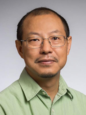
Xiao is passionate about maps, which are used in his field to visually describe data. His research focuses on three dimensions: geographic data, quantitative methods and computational methods. He came to Ohio State in 2003.
“Ohio State was one of the pioneers in the field of quantitative geography,” he said. “That’s a branch of geography that uses quantitative and computational methods to solve spatial problems. It’s a good fit for me. I was extremely excited to be accepted here.”
Xiao is the head of the department’s new graduate degree, a master’s degree in geographic information sciences and technology (GIST). The program debuted last year, and enrollment is growing quickly. Born out of a need for more advanced geography degrees in fields like banking, insurance and public policy, the MGIST allows students to explore the subject more deeply.
“We want them to get a better sense of the field,” he said. “What can data tell us? What are the problems in the data? How do you use new technologies?”
With technology as one of the focuses of the program, it only makes sense that the degree is obtained entirely online (although students can apply for in-person courses). In addition, an online program allows for the flexibility that working students need.
“Our students are mainly professionals,” Xiao said. “People who already have a job or are close to getting a job. They don’t plan to go full-time on campus, just to study.”
To graduate from the program, participating students will take 11 out of the 15 courses currently listed in the curriculum, including a capstone project that will showcase their GIST knowledge and skills.
“Ohio State has a long history with the field,” he said. “I think we should provide attractive options for students, and not just our students but everyone looking for an advanced degree from a high-quality brand like Ohio State. We have the capacity to do that, so we are.”
Xiao said that, for the uninitiated, GIST is a confusing subject. To better understand it, he asks people to think of something they use daily.
“Look at Google Maps,” he said. “Google Maps is a celebration of the convergence of different spatial data sources and computation technology. We are at the point where we have a lot of geospatial data from traditional sources, like surveying data, and also from drones and satellites. Social media can be geotagged, right? What’s the impact of so much data? Google Maps is a perfect example of how specifically maps can help.”
After graduating from college with a degree in geography in China, Xiao was introduced to the field and never looked back.
“That was the first time I learned that there’s something called GIST,” he said. “I learned you can use a computer to make beautiful maps. I’d never done that before. I’d never had a computer. It was totally new, and I was totally stoked. I realized this is going to be my life.”
He is excited to share his enthusiasm with more students, at a graduate level.
“Where do our students go after they graduate, our undergraduate students? Do they want more? An advanced degree can help them get a better job, get better pay and advance their careers.”
